Wednesday 24 October 2012

Danga Bay Marina

Hi everyone,
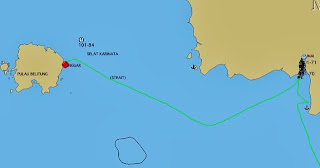
Today we motorsailed from Nongsa Point Marina in Indonesia to Danga Bay Marina in Malaysia.  The 52nm passage took 9 hours with a lot of assistance from tidal current.

Into the fray
The passage didn't start well as the engine stopped several times due to air in the fuel system.  We eventually managed to properly bleed the system.  Only after it ran for an hour without problems did we cross the Traffic Separation Scheme channels which are very busy with big, fast shipping.


The shipping lanes were full of a wide variety of ships, from small coastal tankers and tugs towing barges to huge VLCCs (very large crude carriers), container ships and bulk carriers.  There were also a handful of Singaporean patrol boats out and about.  Overhead Singaporean F-5 Tiger, F-15 Eagle and F-16 Falcon jets were doing laps around the island state.  Lovely noise!

Evading yet another tug
Dodging a big Italian
Singaporean patrol vessel
Extensive anchorage
After crossing the lanes safely we navigated along the narrow strip between the shipping lane and the Singapore Port Authority limit.  We're not allowed in the former and not particularly welcome in the latter since we were bound for Malaysia.  Small coastguard launches patrol the port and they kept a close eye on us.

Once into the narrow strait between Malaysia and Singapore the big ship traffic disappeared and we only had to contend with barges and the Singapore coastguard vessels.  We passed under the Second Link (Tuas) Bridge, using the first span E of the middle span, and still finding plenty of clearance for our little 15m air-draft.


We arrived off Danga Bay marina and had to find our way past an extensive floating barrier.  There is a lot of dredging going on near the marina and it was far from clear which path to take.  We found our way in with help from the marina and from Kakadu.  Apparently several yachts have gone the wrong way and run aground so one needs to take care.

After arrival Graham and I registered our boats at the marina while the ladies took a bus to one of the local malls for initial food supplies.  In the evening we walked along the side of a 4-lane motorway where a lot of the manhole covers were absent - avoid the black holes!  It was worth it when we found an excellent Indian restaurant where we had a huge, quality feed for A$12 per person.  We found a quieter route back to the marina.

The marina jetties are in good shape here, but the marina buildings are somewhat run-down.  There is no laundry on site and the gents loos/showers are out of order for renovation.  The Danga Bay area seems very popular in the evenings but is deserted all day.  At night the buildings are nicely lit up and one barely notices the warped planks on the walkways!

Today we got our Malaysian iPhone SIMs so are online again.  We went with Maxis which has a big office near the marina.  This afternoon Graham, the skipper of Two Amigos and I were shuttled around the various offices to carry out our clearing in to Malaysia.  The ladies went shopping at another mall to check that out.  This evening we'll eat at the Italian restaurant on site, for which we got MR50 credit after paying our MR100 fee for a week in the marina.

Tomorrow we expect to do a day trip to Singapore.  It's a reconnaissance mission to see just how long it takes and how long one ends up with to do useful stuff in Singapore.  The lads will visit the electronics and marine chandlery mall while the ladies are looking into having some clothes made.  Good fun for all!  :)

Monday 22 October 2012

Zen Again's Sail Indonesia 2012 General Comments

Hi everyone,
Now for some general comments on our Sail Indonesia experience.  Needless to say, these are our personal opinions.

The one-liner for our experience was this:
  • "Looking ahead, much confusion; looking back, all great fun".
What We Hoped For:
  • Good sailing in company with yachts from around the world
  • Simplified provision of CAIT (Cruising Authorisation Indonesian Territory) and other paperwork
  • Organised events at regional towns along the way
  • Time to explore key places such as Lombok, Bali and Kumai
  • Readily available diesel, drinking water, laundry services and rubbish disposal
  • We had hoped to do the eastern route, but engine problems in Dili forced us to change to the western route
Main Towns We Visited:
  • Kupang (Timor) - cleared in here
  • Kalabahi (Alor) - great welcome and tours
  • Lewoleba (Lembata) - ditto
  • Maumere (Flores) - anchored off nice Sea World resort
  • Labuan Bajo (Flores) - did tour of Rinca Island to see the dragons
  • Medana Bay (Lombok) - good welcome and tours
  • Lavina Beach (Bali) - spent several days exploring central/northern Bali
  • Kumai (Kalimantan) - great tour to see the Orangutangs
  • Manggar (Belitung) - friendliest place of all, with free fuel and water
  • Nongsa Point (Batam) - nice marina and resort; we cleared out here
Other Favourite Places:
  • Kroko Island, at N end of Selat Boling - lovely beach and marvellous snorkelling
  • Tangil Island, N of Riung on Flores Island - ditto
  • Bay in NE corner of Komodo Island - quiet spot with marvellous snorkelling
  • Batumonco Bay in NW corner of Komodo Island - ditto
  • Banta Island, NW of Komodo - spectacular spot with marvellous snorkelling

What Was Good:
  • Meeting so many yachties from so many places with such diverse cruising experience
  • Meeting so many friendly Indonesian people
  • Seeing so many interesting "off the beaten track" places
  • We enjoyed great tours in Alor, Lembata, Rinca, Lombok, Bali and Kumai
  • Most towns were reasonably well organised with regard to diesel, water etc
  • Cheap, clean diesel at all the major towns
  • Good drinking water supplied in blue 19litre "galon" bottles
  • Completed our first overseas cruise
What Wasn't So Good:
  • Very little wind, especially N of the islands - we motored for 2/3 of the rally
  • The 2012 rally does not appear to have been as well organised as in previous years
  • The schedule of events became increasing confused as the rally progressed
  • The (government supplied) CAITs expired before the rally ended
  • Negotiating our tour in Kumai ultimately worked out well, but some of the people are very dodgy (ie not negotiating honestly or in good faith IMHO).  This was the only place we encountered this during the rally.
What Was Simply Indonesia:
  • Learning to deal with the locals surrounding your yacht and asking (or  trading) for clothing, hats, sun glasses, fishing gear, swimming goggles, reading glasses, sweets etc, or simply wanting to try out their English - if you don't want to meet the locals don't do Sail Indonesia!
  • Learning to be patient when waiting for delivery of diesel, water, laundry etc.


Zen Again's Sail Indonesia 2012 Technical Summary

Hi everyone,
It's time for some technical statistics on our Sail Indonesia 2012 adventure.  The statistics include our participation in the Darwin to Dili Rally as well as Sail Indonesia.  We sailed the western route of Sail Indonesia, entering Indonesia at Kupang and exiting at Nongsa Point.

Zen Again was one of the smallest yachts on the rally this year.  She is a 34' (10.4m) cutter-rigged cruiser/racer monohull displacing about 6500kg.  She has 200 litre freshwater tanks plus four 20 litre jerry cans; and 140 litre diesel tanks plus five 20 litre jerry cans.  We have no water maker.

Statistics:

  • Duration = 98 days
  • Distance Logged = 2541nm
  • Sea Time = 528 hours
  • Average Speed = 4.8 knots
  • Average Distance = 26 nm/day
  • Engine Hours = 331 hours
  • Fuel Consumed = 560 litres
  • Fuel Consumption Rate = 1.7 litres/hour (20 year old Yanmar 3GM30F)
  • Water Consumed = 910 litres
  • Water Consumption Rate = 5 litres/person/day (approx)

What Worked:

  • Garmin BlueChart G2 electronic charts (better detail and fewer offsets than other brands)
  • GE2KAP translation of GoogleEarth imagery for viewing in OpenCPN chartplotter - brilliant!
  • AIS receiver
  • Good autopilot
  • Reaching sheets (ie separate sheet run to block on toe rail)
  • Boom brake (ours was a A$40 mountaineering "figure of eight")
  • Quiet cabin fans (ours are Caframo)
  • Soda water maker (ours is a SodaStream)
  • Waterproof video camera (ours is an Oregon Scientific ATC9K)
  • Jiggler hoses for transferring fuel and water from jerries to main tanks (easy to use at sea)
  • Scrubbing brushes for regular hull cleaning

What Broke:

  • Engine Freshwater Pump failed near Dili (getting replacement was quick but costly)
  • Engine Freshwater Pump / Alternator V-Belt failed enroute Belitung-Mesanak (spare fitted)
  • Two mainsail luff slug webbings replaced - one pre-emptively replaced, one failed at sea
  • One of our two freshwater bladders developed a leak near Dili (removed and not replaced)

Spares We Used:

  • 9 litres of oil, including 3 litres for two oil changes and 6 litres of topping up
  • 2.7 litres of coolant (when replacing freshwater pump)
  • 2 oil filters
  • 2 primary fuel filters
  • 1 secondary fuel filter
  • Webbing straps and whipping twine

What Wore:

  • Boom brake attachment chafed boom vang attachment, so replaced with webbing
  • Headsail sheets now look quite old and worn
  • Anchor chain marks abraded away


Sunday 21 October 2012

Nongsa Point Marina

Hi everyone,
We arrived at Nongsa Point Marina at 1630 yesterday.  We had a better than expected passage from Mesanak Island, with quite a nice steady wind for about half the time.  Once in the channel between Bintan and Batam islands there were many ships, both at anchor and underway.  Some of them do 20 knots, and the ferries are faster still.  It's an amazing transition from an island with small fishing villages to having the skyscrapers of Singapore in sight in a single day.  We are in a pen at 01 11.813N 104 05.833E.

Zen Again Track
It was nice to be able to step ashore, have a hot shower and buy a beer at a bar, apart from the expense of the latter.  The marina includes a resort (or is it vica versa?).  Either way, the resort facilities are available to marina users, including showers, laundry, bar, restaurant, shuttle bus etc.  It has taken a day for it to sink in that we have now completed Sail Indonesia.

Last night we splashed out on dinner at the restaurant.  It was an "all you can eat" affair for S$30 per person, including one drink in the price.  We ate with the crew of MV Lizzie, one of the few motor boats which did Sail Indonesia this year.

Today we made a start on our laundry, doing it aboard since the marina laundry had a long queue.  We also had a good cleanup below, and emptied our last jerries of water and fuel into their respective main tanks.  This afternoon we enjoyed the pool (although it was pouring with rain by that stage), then settled down to use their free WiFi.  Which of course is what I'm using right now!

Zen Again at Nongsa Point
We expect to clear out of Indonesia and depart Nongsa Point on Tuesday morning to move on to Danga Bay Marina in Johor Baru, Malaysia.

Friday 19 October 2012

Mesanak Island

Hi everyone,
We are now anchored in the bay on the SE side of Mesanak Island with Kakadu and Swiss yacht Sostene. We are at 00 24.316N 104 32.737E in 9m over sand. Yes, we are in the northern hemisphere!

Zen Again Track
Mesanak Island is about 25nm NW of Kentar Island, so we have progressed further towards the Singapore area than anticipated. Kakadu arrived off Kentar before dawn and decided to press on to here. We arrived about 4 hours behind them after a 56 hour passage. We motored for 43 hours which was very tedious, but had several good sails between the motoring sessions.

Last night we motored a lot. At one point we came upon a group of 50+ fishing boats all closely packed together. Needless to say we gave them a wide berth. In the early morning a W wind came in and we had a great sail for several hours. We were close reaching at a steady 7 knots boatspeed. Of course that wind died and the motor went back on.

Calm seas, with scattered thunderstorms
At 0917 this morning we crossed the line, offering King Neptune a tot of rum in hopes of his being kind to us. At midday a rainstorm clobbered us with heavy rain, some small hail and 25-30 knot winds. The boat needed a wash, and so did we! Thanks King Neptune.

On the equator - exactly! 
All in all it was quite an eventful passage, what with disintegrating V-belts, filtering and transferring fuel at sea, crossing "the line" and catching our first rainstorm at sea since the Darwin-Dili rally.

At Mesanak Island
Tomorrow we expect to head towards Nongsa Point Marina. There we can have a shower, hopefully do the laundry, and arrange to "clear out" of Indonesia. Once cleared we will probably head over to Danga Bay Marina in Johor Buru, Malaysia, which is immediately north of Singapore. The Sail Malaysia rally starts from Danga Bay early next month and in the mean time we will explore Singapore by land.

Thursday 18 October 2012

Enroute towards Kentar Island

Hi everyone,
We've had a varied 24 hours since the previous blog. The light wind we had yesterday afternoon died after sunset and we had to motor all night. The sea was "glassed out" for hours. At about midnight the engine started making nasty noises so we quickly reduced revs to idle and had a look at the engine. The V-belt which drives the freshwater pump and alternator was disintegrating. We shut down the engine and fitted a spare in 15 minutes. Hopefully it will last for as long as the original, which was on the engine when we bought the boat.

This morning the wind returned, albeit still very light, allowing us to motor-sail (sort of). At around 1100 a rainstorm appeared to have our name on it, giving us some good sailing for an hour. We even had to put a reef in for a while as winds got up over 20 knots. We didn't get any rain. Once the storm moved on we were back to motor-sailing.

We are clearly out of the SE trade wind season here now. Since Belitung cumulus clouds have built up each morning, with some becoming quite large rain/thunderstorms. In the evening they dissipate, and last night (for example) we had clear skies from about 0200. It's sultry and humid all day and all night, with the heat from the engine adding to the discomfort.

Scattered thunderstorms
Last night we were visited by a migrating swallow. He flew around the boat, trying out places to land and hovering over parts of the boat. We thought it had flown away, but in the morning we found him perched on the pushpit. From there he flew into the cabin, and we think he flew out of the forward hatch - we can't find him anyway! Kakadu reported they had birds aboard too when we did our sked. Other wildlife seen includes flying fish and a sea snake.

We now have about 80nm to run - just a Fremantle to Bunbury! It looks like the wind is starting to die again, so we expect another tedious motor overnight. In preparation for yet more motoring we filtered and transferred 40 litres of fuel from jerry cans into the main tanks while motoring this morning. The main tanks now have plenty of fuel to get us to Kentar Island.

We expect to cross the equator tomorrow morning. Rum and other tributes have been prepared to offer King Neptune!

Wednesday 17 October 2012

Departed towards Kentar Island

Hi everyone,
This morning we departed Belitung Island with sv Kakadu towards Kentar Island, a passage of about 240nm to the NNW. Four other boats departed at the same time, two of which are heading for Lingga Island which is a larger island west of Kentar Island.

We motored for several hours this morning until a light easterly breeze settled in. It was only 5-6 knots and when we tried to sail we were doing only 2-2.5 knots. Ultimately Kakadu shamed us into changing up from our "cruising" 100% Number 2 jib to our "racing" 150% Number 1 Genoa. With that we were able to do 3-4 knots, occasionally more. We've been having a lovely sail since then.

We've seen very little traffic. A couple of ships in the distance and a handful of fishing vessels. The sea is flat and the sky is half-filled with Cumulus clouds. Nice. Another 3-4 knots of breeze and it would be perfect.

At this speed we'll be at sea for two days and three nights, but in these light but usable winds it will be very pleasant. Of course the conditions are very unlikely to remain static!

Trust all's well where you are.

Tuesday 16 October 2012

Cape Kelayang (Day 2)

Hi everyone,
We had a great night's sleep last night thanks to the light winds and anchorage protected from the SE breeze.  This morning we had a swim, scrubbing growth off around the waterline - a never ending job in the tropics.  After that we soaped-up in the cockpit and jumped back in to rinse off, then had a quick shower in the cockpit using our fresh-water solar shower.  Very nice.

At 0900 we met Graham and Anne from Kakadu ashore and went for a walk around part of the bay.  There are some very nice beaches and the boulders certainly make them spectacular.  Behind the beaches are the remains of what appears to be either defunct or never completed resorts.  Doesn't exactly add to the natural attraction.  There are new buildings being constructed, but these appear to be where shows and speeches would be held, not where tourists could stay.

Bouldery beach
More boulders
After the walk around we had lime juice, banana pancakes and coffee for $2 per person.  We sheltered in the cafe as a thunderstorm came through with 30+ knot NE winds and heavy rain.  Once that passed we returned to our dinghies and headed back to the boats.  The NE wind was blowing directly into the bay and a 1+ metre breaking sea was setting the anchored boats pitching wildly.  It also made the dinghy ride "exciting" and extremely wet!

Back aboard safely we let out a couple more metres of our nylon snubber line on the anchor rode.  It was stretching and recovering dramatically, probably stretching 0.5m over a 4m line.  That's what nylon's good at!  The bow of the boat was going under at times as she pitched.  Happily our Manson Supreme anchor held well.


Riding out the thunderstorm
Several more thunderstorms came through.  It seems a low pressure area has developed to the east of us and is creating the storms.  We had some heavy rainfall with strong winds, then steady light rain for several hours with quite a sea running through the anchorage.  By mid-afternoon the rain stopped and the wind reduced to 5-8 knots, and the sea was dying down.

Later in the afternoon I went ashore and had four 20 litre diesel jerry cans filled.  With the almost full main tanks they give us plenty of fuel to get to the Singapore area.  Even if we have to motor all the way - which is a real possibility.
Tomorrow we plan to depart towards Kentar Island which is just across the equator.  Graham and Anne on Kadadu may have a line-crossing ceremony in store for us.  They have crossed the line before, so are (apparently) entitled to play King Neptune.  It's a worry.  :)

Using GoogleEarth Images for Marine Navigation

Hi everyone,
This post is for navigators interested in adding one more source of useful data to their armoury.  For us, GoogleEarth imagery has proven to be very useful, particularly in an area of the world in which official charts are poor.  Please note this blog states my opinion only as a cruising sailor.

The Problem:

I learned about using GoogleEarth as an aid to navigation in preparing for the Sail Indonesia 2012 rally.  Charts in many parts of the world are not as accurate as we are used to in Australia, Europe, North America etc.  Hence I was keen to find other sources of information to assist my navigation during the rally, particularly in inshore, reef-strewn waters.

Simplistically navigation is the answering of two questions.   First - where are we now?  Second - where should we go next?  It is a commonly held view that the first question has been answered by GPS, and so the modern navigator's role is to answer the second.  That's true in many, perhaps most, parts of the world, but certainly not in all.

The question of "where are we now" certainly became much simpler with the advent of GPS.  However the GPS-derived position is of less value (perhaps positively dangerous) if the chart in use has an offset from GPS.  In areas where offsets exist there are commonly charting errors or omissions in addition to the offset.  These charts are usually based on pre-GPS surveys, and sometimes from surveys more than a century old.  Hence a GPS position is of limited value without a modern chart.  In fact in inshore waters you may well be better off without the GPS position, reverting instead to traditional methods of navigation.

So the problem is how to gather additional information which could highlight chart offsets, and allow identification of useful locations (eg anchorages) and hazards (eg uncharted reefs).

The Solution:

I had heard of sailors using GoogleEarth to identify potential anchorages.  This simply allowed one to note positions while connected to the internet and using GoogleEarth, and transfer the positions to a chart (paper or electronic).

Then the chart plotting software OpenCPN, in concert with the utility program GE2KAP, provided the ability to display charts derived from GoogleEarth images.  Once saved to disk, no internet connection is required to use the KAP files in OpenCPN.  One simply clicks on a button to select a conventional chart or a KAP format chart.  KAP format charts (I'll call them KAPs hereafter) seemed like a good idea so I did some trials.

As an initial trial I made KAPs of the Darwin harbour area where we were located at the time.  These demonstrated the good alignment of GoogleEarth images with Australian charts, which we knew to be accurate.  They were very well aligned with Seafarer raster charts, and also with Garmin BlueChart, Navionics, and CM93 vector charts.

Subsequently I made KAPs of the major destinations we expected to visit during Sail Indonesia.  These were compared with Garmin, Navionics and CM93 charts for each location.  This clearly showed their value, showing various offsets and also some significant differences in port structures.  One issue with the GoogleEarth imagery was shown, which was that imagery of remote areas can be several years old, sometimes approaching 10 years - especially if one found cloud cover spoiled the latest imagery!

During Sail Indonesia the initial KAP files created proved very useful, and also proved very popular when offered to other participants.  Most critically, the alignment of GoogleEarth imagery with GPS locations was demonstrated to be extremely accurate, without exception in our experience.

Our experience was that entering an anchorage with an offset-free chart on the plotter was certainly an aid to navigation, where displaying a chart with an offset was a hazard, even if known to be present.  Clearly, entering reef-strewn anchorages was a job involving the Mark 1 Eyeball, depth sounder etc, but the accurate KAP helped.

In locations such as anchorages/ports and their approaches we identified apparent reefs on the KAPs which were not charted.  In almost all cases the Mark 1 Eyeball confirmed their presence.  This is clearly a critical advantage of KAPs.  However caution is necessary.  It appears that Google "greys-out" their imagery away from the shoreline, so reefs you'd otherwise expect to see are not present.  This is probably to reduce the size of downloads intended for shore-side use.  Therefore it is still prudent to use the Mark 1 Eyeball, depth sounder and charts in addition to any use of KAPs.

Later in the Sail Indonesia rally a "library" of KAPs circulated around the participants.  These proved extremely popular and were certainly an aid to our navigation.

Summary:

Here are the benefits and cautions I've identified when using GoogleEarth imagery "charts" for navigation:

Benefits:
  • Well aligned to WGS-84 GPS positions
  • Identifies chart offsets
  • Identifies potential anchorages
  • Identifies some hazards (eg shallow reefs) close inshore
  • Presents helpful views of features ashore (e.g. mountains, towns, rivers etc)
Cautions:
  • Obscures offshore hazards
  • Clouds can obscure parts of images
  • Imagery may be several years old
  • Not an official Google product as such
  • Unknown whether Google provides any assurance regarding WGS-84 alignment
Used with caution, GoogleEarth images can be very helpful to inshore navigation in poorly charted areas.  They provide a different perspective which may well be useful in well-charted areas.

Monday 15 October 2012

Cape Kelayang

Hi everyone,
Today we sailed from Manggar to Tangung (Cape) Kelayang, also known as "Boulder Bay".  The 55nm passage took us 11 hours, motoring for most of the way due to very light winds.  We are now anchored amongst about 15 other yachts at  02 33.224S 107 40.470E in 6m over sand/mud.

Zen Again Track
The passage was made a little more interesting by a set of thunderstorms which passed us by, but did give us a little wind for a short time.  Other yachts had much more excitement, with some experiencing 40 knot winds and torrential rain.  The seasons seem be changing, with the SE trades and clear skies giving way to cloudy skies and (at this stage) light and variable winds.

Thunderstorm nearby
Boulder Bay is the best known tourist attraction on Belitung Island.  It is a nice bay with white sand beaches and huge granite boulders scattered along the beach and across the bay.  We plan to explore tomorrow, in addition to obtaining more fuel to ensure we have plenty to get to the Singapore area.

We expect to stay here until Wednesday, when we'll probably head for Kentar Island, 240nm north.

Sunday 14 October 2012

Manggar (Day 2)

Hi everyone,
We've had a great time here at Manggar on Belitung Island for our second day.

Last night we went ashore an hour earlier than required in order to have daylight for the dinghy trip in.  That gave us time to walk around the area.  The local houses are interesting, with the newer ones being quite impressive and featuring extensive use of tiles - not only on floors but also outside walls.  They like bright colours here!

After the walk we returned to the meeting point and chatted with the local organisers.  They have big plans to develop a marina here, but don't yet have funding.  Various cruisers gave their opinions about such a prospect.  I think the main point is that Manggar's location at a river mouth is very advantageous.  Step 1 is to dredge the bar so yachts can get in safely.  Just having a calm anchorage where boats can be safely left while crews tour ashore will attract yachts.  Then a marina could be gradually built if sufficient yachts use the port.

With all the cruisers (about 20 people) gathered we were bussed to the venue for dinner, traditional dancing and finally modern singing/dancing.  The event was free and included free beer!  The traditional dancing was interesting with the girls wearing aprons as part of their colourful outfits, and colourful striped socks too.  The band featured traditional instruments but also an accordion and violin.  We guess these are the result of Dutch influence during colonial times.  All very colourful, and we were required to join the traditional dancing after the demonstration.

This morning we brought aboard our water supplies and retrieved our diesel jerry cans.  It proved impossible for the organisers to provide free fuel on a Sunday.  Given we have enough fuel aboard to get us to the Singapore area we decided not to delay our departure to load extra fuel.

This afternoon we went ashore again to chase our port clearance papers.  We couldn't depart Manggar without having the proper stamped forms.  While waiting for the papers the organisers arranged a short tour for us.  Two tour guides took us around on the back of their motorbikes.  We visited the area of town where a complete new compound is being built for their official Sail Indonesia events later this month.  They are building a nice cafe strip adjacent to the beach where their traditional boats are kept.  I really hope some boats are still passing through when the official events are held.

The tour then took us to Samak Hill which overlooks the sea on the site of old Dutch buildings.  The site has a big restaurant and we had some great coffee there.  The guides took plenty of photos at each stop on the tour.  Here's one...

Nice Coffee!
When we returned to the port our papers were ready for us and we bade farewell to Hans and his crew. They have made us very welcome and really gone out of their way to meet every need.  It's a great shame the dates of the official events here are so late - far too close to the start of Sail Malaysia given the distance to the Singapore area from here.

On returning to Zen Again we found Dan and Elise on Babar had arrived in the anchorage.  We spent an hour with them, catching up on news and briefing them on Manggar.  After returning to Zen Again from Babar we saw The Doctor heading in to the anchorage and talked to Rob and Diana on the radio.  Good to catch up with our Tipperary Waters Marina friends again.

Saturday 13 October 2012

Manggar

Hi everyone,
We are anchored off the town of Manggar on the east coast of Belitung Island.  We arrived at 0650 this morning, anchoring in 5m at 02 50.740S 108 18.207E.  The 240nm passage took 49 hours and we motored for all except 1 hour.  For much of the passage we were motorsailing, which was better than simply motoring.  Overall though it was very tedious.  It was good to have Kakadu in company with us.  We stayed in touch by VHF and HF depending on how far apart we were.  Kakadu arrived an hour after us, having managed to sail more than us overnight.

Zen Again Track
Track in to anchorage off Manggar
Note1 - port/stbd marks not present
Note2 - uncharted shallow area just N of anchorage
Overnight we motored along at reduced revs to ensure arrival at dawn.  When dawn arrived we were approaching some outlying islands and made our way from there in to the anchorage.  We were assisted by some GPS waypoints emailed to us and radioed to us by other Sail Indonesia yachts.  The anchorage is off the bar of the river mouth around which the town is built.  Some yachts have crossed the bar into the river, which certainly offers a nice calm anchorage but the bar is too shallow for us.

Sailing!
On arrival we called the local coordinator and were invited ashore to clear in to the port and to arrange fuel and water supplies.  We were also told that a free lunch and dinner were being laid on for the Sail Indonesia yachts.  So despite the overall Sail Indonesia schedule being poorly thought out some of the towns are adapting to the reality of yachts arriving much earlier than officially dictated.

We went ashore and presented our papers, and also our empty jerry cans (4 for water, 5 for diesel).  The local people were very friendly and several have excellent English which certainly helps.  After the formalities and promises of filling the jerry cans we joined a dozen or more other cruisers for a free lunch.  We were all driven to a local restaurant and had a very good feed.

Kakadu at anchor off Manggar

We returned to the boat after lunch after explaining we couldn't stay ashore all day going from one feed to another to another - we needed some sleep!  We promised to return for the dinner with traditional dancing this evening.  The dinghy ride back to the boat was extremely wet and we found the tide had turned creating a nasty wind over tide situation.  The boats were bouncing around all over the place and getting aboard was a challenge.  Hopefully the situation will ease before dinner time!

Friday 12 October 2012

Approaching Belitung

Hi everyone,
Today has been hot and horrible. We've been motoring continuously in very light winds. Much of last night the water was "glassed out", meaning no wind whatsoever. Today the temperature has been well over 30C with high humidity, plus the heat from the engine has turned the cabin into a cooker. No fun at all.

Nonetheless, we are making steady progress towards Belitung. At the moment we are motor-sailing in a light SW breeze of about 3-4 knots. We have about 60nm to go. We have reduced engine revs to 1600 to help ensure we don't arrive in the dark. The entrance to Manggar harbour is quite shallow and we are uncertain of the chart accuracy and offset, so we need to approach in daylight.

Last night we managed to get too close to a fishing vessel and found ourselves inside a large ring of buoys off one side of the vessel. Since we had got in unscathed we guessed we'd get out similarly, so we very gingerly snuck across the net between two buoys. The net must have been suspended a few metres below the buoys - luckily! Lesson learned.

This morning we crossed a busy shipping lane SE of the Karimata Strait. The strait separates the Java Sea from the South China Sea. We had ten ships within 10nm on our AIS display at one stage. We had to zig zag our way through, but didn't need to contact any of the ships by radio.

During the day we added diesel from jerry cans on deck to the main tanks. We also stopped the engine for 15 minutes to check fluid levels, V-belts etc. Running the engine for long periods certainly chews up diesel, a little oil (in our trusty old engine), and brings service requirements rapidly closer. We'll probably need to change the oil and filters again before reaching the Singapore area.

Trust all's well (and cooler!) where you are.

Thursday 11 October 2012

Java Sea Again

Hi everyone,
Tonight we're at sea, on our way from the Kumai River to Belitung. Belitung is the roughly circular island west of the southern coast of Kalimantan/Borneo. The passage to Manggar on the east coast of Belitung is about 210nm.

We departed the town of Kumai on Wednesday afternoon after visiting the markets for fruit & veg, and delivery of our laundry. We motored downriver, initially in calm conditions. The wind came up as we made our way downriver, until we were battling into a strong wind directly "on the nose". The engine had a good workout. We anchored with Kakadu and several other yachts at 02 54.281S 111 42.313E in 5m over mud. The anchorage gave good protection from the 20+ knot S wind and we had a quiet evening and night.

Shortly after we arrived at the anchorage one of the bigger yachts headed out rapidly towing a dinghy from another boat. They were off to assist a yacht which had grounded in the approaches to the river. They returned successfully with the yacht in the early hours of the morning.

We got underway at 0600 today in company with Kakadu. We retraced our track into the river mouth, finding minimum depths of 4.5m. Once "in the clear" we sailed for about an hour in about 8 knots of breeze, but then the wind lightened off. We've been motoring or motor-sailing ever since, and are thoroughly sick of the sound of the engine. But very glad it's still "turnin'n'burnin".

This morning we received an email from Sail Indonesia giving dates of the final events at the last two destinations. Unfortunately the dates are ridiculous, allowing next to no time to get from the last destination to the Singapore area to join the Sail Malaysia rally. We still plan to visit the places - Belitung and Bangga - but prior to the official events. This year's Sail Indonesia has been poorly organised (IMHO), but great fun nonetheless.

Right now we're motoring along under a stary sky. There's a thunderstorm in the distance to the north. There are about a dozen fishing vessels scattered around us - all well clear. There's just a 3-4 knot breeze from the S, and that is slowly dying. We're heading SW to round the shallow water off the SW coast of Kalimantan/Borneo. Doing 5 knots through the water, with the sails adding 1 knot to the 4 knots from the motor (running at 1800rpm in "economy cruise mode"). In a few hours we'll be able to alter course to the NW and head for Belitung.

Trust all's well where you are...

Wednesday 10 October 2012

Orang Utans

Hi everyone,
On Monday and Tuesday we toured Tangung Puting National Park, visiting three of the camps in the park to see the famous orang utan rehabilitation activities.  We travelled on a klotok "houseboat", about 50' long, on which the four passengers had a deck to ourselves.  We went with Anne and Graham from sv Kakadu.

Heading up river
We departed around lunchtime on Monday and travelled downriver a mile or so before turning up a tributary of the main river which is a boundary of the National Park.  We soon started to see interesting animals - various colourful birds, macaque monkeys and proboscis monkeys.  We also saw a 1m+ lizard swimming in the river.

A gathering of klotoks
At about 2pm we reached the first camp, Tangung Harapan.  On stepping ashore we found a large male orang utan swinging around in the nearby trees.  Amazing animal.  He eventually climbed down to the ground and walked through the group of tourists.  They glide over the ground silently, unlike moving in the trees where they can be quite noisy.

Orang Utan
We saw about 8 orang utans during the feeding at this camp.  Staff place bunches of bananas on a raised platform and the orang utans come down, usually one by one or mother with young.  Sometimes they squabble over access to the bananas.  Usually the smaller ones hang around in the trees nearby, so a group is visible throughout the session.


From the first camp we continued upriver, seeing many more monkeys in the trees along the riverside.  They like to sleep near the river and go into the jungle during the day.  We moored at the side of the river (by throwing a couple of car tires on lines into the riverside reeds.  With the engine and generator off the noise of the jungle was spectacular.  Coincidentally I'm reading the book "Heart of Darkness" at the moment.  The Lonely Planet guide mentions it as a book which captures the feel of travelling up this river.  I agree.  Happily we didn't encounter Kurtz!

Proboscis monkeys

As the sun went down the flying bugs were many and some of them large.  Well coated in repellant we settled down for an evening of Scrabble which was very enjoyable.  Then we retired to our mosquito net protected beds.  The nets worked extremely well.

The following morning we resumed travelling up the river to Pondok Tangui camp.  Here we saw the best array of orang utans of the three camps.  Note - that's just our experience on these two days.  The dominant male was first to appear, and he did so by materialising from the rear of the platform rather than noisily descending from the trees.  He made a great entrance, then proceeded to strike poses not unlike human body builders!

Big daddy, plus interloper
Who's watching who?
Mum and baby
Inquisitive
On the road to population recovery? 
From the second camp we went further upriver to Camp Leakey.  This is up a further tributary where the water changes colour from muddy to tannin-stained but quite clear.  The river narrows considerably and we saw many crocodiles, more monkeys, amazingly colourful kingfishers and various other colourful birds.


At Camp Leakey we saw another group of orang utans.  The feeding was joined by a gibbon which demonstrated its amazing aerial agility, and by a family of bush pigs.  The smaller orang utans were clearly wary of the pigs, which didn't dare climb the platform but stalked around it.  One of the orang utans dropped a bunch of bananas to the ground to decoy them away so he could come down from the platform to get to the tree he wanted to climb.


After Camp Leakey we travelled back to Kumai.  The return took 4 hours, about half of which was after sunset.  We saw one orang utan, several crocodiles and kingfishers, and many monkeys before sunset.

After dark we were entertained by countless fireflies.  In large groups in trees these looked for all the world like Christmas tree lights.  Their light pulsates, sometimes synchronised, sometimes not.  One visited us and we established each is about 5mm in length.  Amazing how much light each emits.

All in all our tour was a marvellous experience.  The orang utans were amazing to see up close & personal.  The other wildlife was spectacular.  But the overall experience of travelling up and down a tropical river was actually the highlight for me.  Some take a one day tour which use small speedboats - my advice is take the time for an overnight tour!

Today we're going ashore to the markets and hopefully our laundry will be returned.  Then we plan to head downriver.  We may anchor overnight outside the bar, or if we still have plenty of daylight we'll continue out into the Java Sea.  We prefer to cross coastal waters in daylight due to the many fish traps and nets.  Either way our next destination is an anchorage off the NW coast of Belitung island.

Monday 8 October 2012

Kumai

Hi everyone,
Yesterday we spent much of the day ashore arranging a boat tour and exploring the town of Kumai and the surrounding area.  Prior to that we took aboard water and fuel, and arranged to have a very large bag of laundry done.

View of Kumai from the anchorage
Boats in the anchorage
The boss of the tour company we chose offered to drive us inland to a nice place for lunch.  The lunch was good but far more interesting was the 20 minute drive.  It was interesting to see the surroundings of Kumai and a town inland (unsure of its name).  The town featured a number of large statues at the centre of traffic roundabouts.  One of them was a statue of the foot of a large tree (the rest presumably having been felled).  There was a different animal on each branch and orang utangs beside the tree.  All the animals looked sad, unsurprisingly.  I presume the statue is intended to highlight the consequences of logging.

Statues aside, logging continues at a rapid pace.  We've seen huge barges carrying logs proceeding downriver.  The air here is smoky continuously, albeit worse some times than others.  Sometimes it creates a real "pea soup" fog reducing visibility to 100m or so.  I'm sure we haven't seen the worst of it in our short stay so far.

As we approached Kumai on Saturday afternoon our first view of the town seemed to show large apartment blocks.  As we came closer the buildings clearly had no windows.  They are large concrete block houses with a matrix of tiny openings on each side.  Another thing we noticed was continuous birdsong.  We've since learned from other cruisers and from people ashore that they are bird nest soup "factories".

The birdsong is a recording played to attract swifts which enter the buildings through the small openings and build their nests inside.  Thousands of them.  Normally the birds nest in caves.  At the end of the season the birds (parents and young) fly away and the nests are "harvested".  The nests are shipped to China, where I suspect most of the profits are made.  It's amazing that the buildings are right in the middle of the town.  They are ugly, smelly, noisy and probably unhealthy for the local residents.  Very nice.

Hmm, seems cruising is turning me into a greeny!

Saturday 6 October 2012

Kumai River

Hi everyone,
Today we sailed from our anchorage N of Cape Puting to the mouth of the Kumai River and upriver to Kumai.  We logged 40nm in about 9 hours.  We motored for much of the journey upriver due to light winds and regular commercial traffic.  We are now anchored opposite the town in 9m over mud at 02 44.382S 111 44.037E.

Zen Again Track
Zen Again track up the river (GoogleEarth)
The journey upriver was less eventful navigationally than expected.  We followed the waypoints given in the book "101 Anchorages in Indonesia", which match those given in various cruising notes by yachts which have visited previously.  The minimum depth seen was 4.9m, and that was while approaching land initially.

What made the journey upriver interesting was the commercial traffic.  They are moving at 10-12 knots and don't always appear to notice you exist.  We had three ships pass us heading downriver during our journey up the river.  One of them ran aground abeam of us - hope they didn't zig to give us room!  They were high and dry when last we saw them.


Kumai seems to be quite a sizeable town.  Certainly the docks are large and there are several medium size cargo ships, tankers and barges anchored in the river and moored alongside the wharf.

Tomorrow we expect to go ashore to explore, to acquire food and Rupiah, and hopefully will line up a tour upriver "into the jungle" for Monday-Wednesday.

Kumai River (almost)

Hi everyone,
Tonight we are anchored north of Cape Puting, at the SE corner of the bay at the mouth of the Kumai River. We anchored here after a faster than expected passage left us with no light to cross the bar and head upriver to the town of Kumai. We are anchored at 03 23.324S 111 47.903E in 6m over mud.

Zen Again Track
We covered 163nm in 28 hours, for an average speed of 5.8 knots. Not bad at all in winds mainly in the 10 to 15 knot range, on or behind the beam. We had expected a 36 hour passage, which would have put us off the river bar at dawn. Instead we would have arrived at midnight if we hadn't diverted to anchor.

As usual we had to dodge ships and many fishing vessels. Not major incidents though. Kakadu stayed ahead of us and found the spit NW of Cape Puting extends further than charted and is shallower. They gave us a waypoint of 03 24.3S 111 38.8E, where we found at least 5.5m of water. We approached the waypoint from the SSW and departed E towards the anchorage.

Tomorrow we'll head on up the Kumai River, arriving only a few hours later than expected but having had a good night's sleep on anchor!

Thursday 4 October 2012

Enroute to Kumai River

Hi everyone,
We had a quiet day at anchor at Bawean Island today. Baked some bread, checked the engine, topped up the diesel tanks from jerry cans, checked all shackles etc on deck, repacked the asymetric, and then rested for the passage ahead. At 1700 be hoisted the main, weighed anchor and departed Bawean Island. The anchorage was in a very pleasant bay. The locals were friendly but didn't ask for anything from us - a unique experience for us so far in Indonesia.

Unflagged fish trap off Bawean

Last night we had our first real rainstorm since the Darwin-Dili rally. It came through at about 0300 with 30 knots of wind as well as quite heavy rain. Lasted for perhaps half an hour, with most of the rain and wind in 10 minutes. We had a cuppa while checking we weren't dragging. The rain gave the deck and the sheets a much-needed wash. The sheets (ropes) were getting so salty they'd stand upright all on their own.


Tonight we're sailing at about 4.5 knots boatspeed under full main and #2 jib. We're doing 6 knots over the ground, which if we keep up will see us arrive in Kumai in the dark, which we don't want. Our plan is to arrive at dawn on Saturday and then proceed immediately up the river to the town of Kumai. We plan to arrange a tour up-river from there to see the Orang Utangs in particular and the jungle and wildlife in general.

Kakadu departed Bawean Island with us. They're gradually pulling away from us, as they should in nice 8 knot beam reaching conditions. It's certainly champagne sailing, or would be if we could keep up with Kakadu! ;)

Trust all's well where you are.